| 1st of 6 detail section views from Hart Island aerial photo in 1954 DOC annual report | xx |
Recognizing any landmarks above to identify is rather difficult, due to
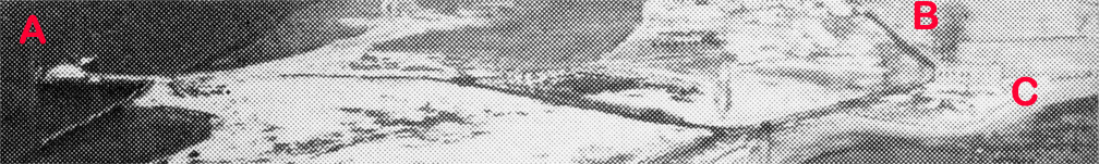
NYCHS digitally applied red capital letters to three areas of note. The red letter "A" designates that "other dock" which most visitors to Hart Island see from their ferry but never go to themselves. It is used by boats other than ferries. The Hart Island slip for the ferry from City Island lies further south than the dock seen in this detail section of the photo. To the left of the red letter B runs a road northward to the island's only hill (not shown in the photo). | xx |
To Next View
To NYCHS home page |
|
Commissioner Anna M. Kross dated transmittal of her 1954 DOC annual report to Mayor Robert F. Wagner as Jan. 1, 1955. So those white block outlines and dark structures seen in the close-up on the other side of the road from the red letter B may be the Nike missile personnel support complex in the making. To the left of the red letter C can be seen the outline of the old stone structure where the road from the red letter A dock turns to the left (northward). Various theories about the building -- believed to be the island's oldest structure -- include it having been used as a mortuary to store bodies (in their coffins) pending burial and as a livery to quarter horses used on the island in pre-horseless carriage eras. Veteran current and former NYC DOC staffers and others who can correct, refine, enhance and increase the information in the close-up image caption above are invited to do so. Include the close-up's virtual tour image number in your e-mail to the webmaster@correctionhistory.org | ||||