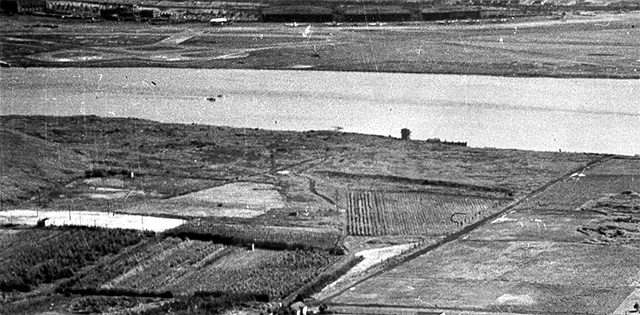
 The 1948 Rikers virtual tour begins with a close-up of the upper left corner section of the full image. The close-up shows, across the top, LaGuard Airport in the pre-jet era of much smaller airliners (a few visible) and much shorter runways but none extending out over the East River Bowery Bay waters close to Rikers. On the Rikers side of those waters note the cultivated farm and tree nursery acres. Also the dock-like facility the left of the island's main roadway that later became Hazen St. Veteran current and former NYC DOC staffers and others who can correct, refine, enhance and increase the information in the close-up image caption above are invited to do so. Include the close-up's virtual tour image number in your e-mail to the webmaster@correctionhistory.org |
1st of 14 detail views of 1948 Rikers Island aerial photo
To NYCHS home page |