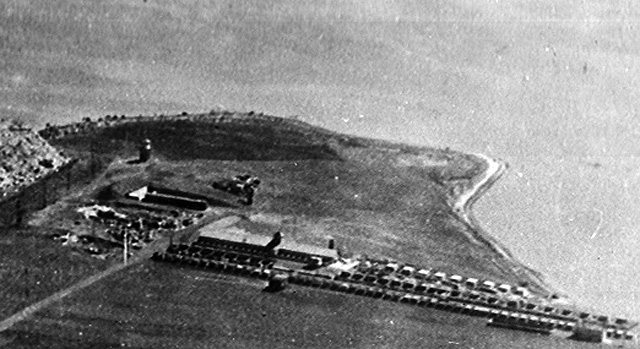
 [Used here through courtesy of Southern Folger Detention Equipment Co.] The 2nd 1930s Rikers virtual tour close-up is to the immediate right of the 1st. It shows the island's farming structures (barn, hen houses, piggery, etc.) near the island's south shore along East River Bowery Bay waters. The farm structures in a 1948 aerial photo close-up elsewhere on this web site appear more in-land (that is, further from the shoreline, closer to the penitentiary buildings) and in an entirely different configuration. See also Page 2 of Rikers Island Had A Farm: E-I-E-I-O and Page 3. Use your browser's "back" button to return here. Veteran current and former NYC DOC staffers and others who can correct, refine, enhance and increase the information in the close-up image caption above are invited to do so. Include the close-up's virtual tour image number in your e-mail to the webmaster@correctionhistory.org |
2nd of 10 detail views of 1930s Rikers Island aerial photo
To NYCHS home page |