|
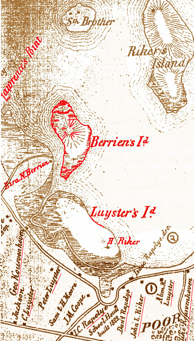
Riker Mansion history makes apparent how Newtown family lines intersect multiple times in sundry ways; specifically how the names on the 1852 map of the area near the Riker homes [enhanced detail above] connect by marriages, wills and property transactions: Riker, Berrien, Lawrence, Luyster, Kouwenhoven, Rapalje. Lawrence's Point and Berrien's Island, seen in the 1852 map, ceased to exist as separate enities and became part of the Con Edison/New York Power Authority complex.The Astoria Generating Station traces its roots back to the 1950s. Luyster's Island ceased to exist as an island and became the NYC Dept. of Enviroment Protection's Bowery Bay Water Pollution Control Plant (aka sewage treatment) whose boundaries include Berrien Blvd. and Luyster's Creek. It began operations in 1939. Both Astoria facilities -- the utility complex and the treatment plant -- are immediately west of the bridge to Rikers Island. The "H. Riker" on Luyster's Island in the map detail above has not been identified in records researched so far but informed conjecture leans to his being Henry, born Jan. 3, 1792, who farmed and lived on Rikers Island and who participated in its sale to Richard and Joshua Totten [See previous Part #5]. Not the caption but the map from which the above enhanced detail was taken DOES appear in Edgar Alan Nutt's 2004 book. Red underlines and red coloring of existing lines were added for emphasis. |
Click to return to Part 6 of NYCHS excerpts from Edgar Alan Nutt's book